

Whether your camping/hiking or just taking in the sights along the Cabot Trail, there is enough for everyone visiting Cape Breton’s amazing treasures. I will discuss 5 amazing hiking trails that will leave you breathless and in awe.
Location: The Cabot Trail is a loop along northern Cape Breton that runs for 300 kilometers. Roughly a third runs through Highlands National Park. You can approach this trail from two different sections. One section entering from Cheticamp to Ingonish or viceversa from Ingonish to Cheticamp. There are two visitor centres located in Cheticamp and Ingonish.
Highlands National Park, Park Information
Cape Breton Highlands National Park Ingonish Beach, Nova Scotia, Canada 902-224-2306
You can do some research on Highlands National Park, Cape Breton here.
You can make campground reservations with Parks Canada at: 1-877-737-3783
TOP 5 HIKING TRAILS IN CAPE BRETON, NOVA SCOTIA, CANADA
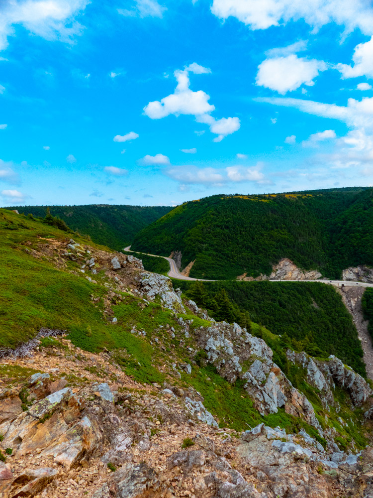
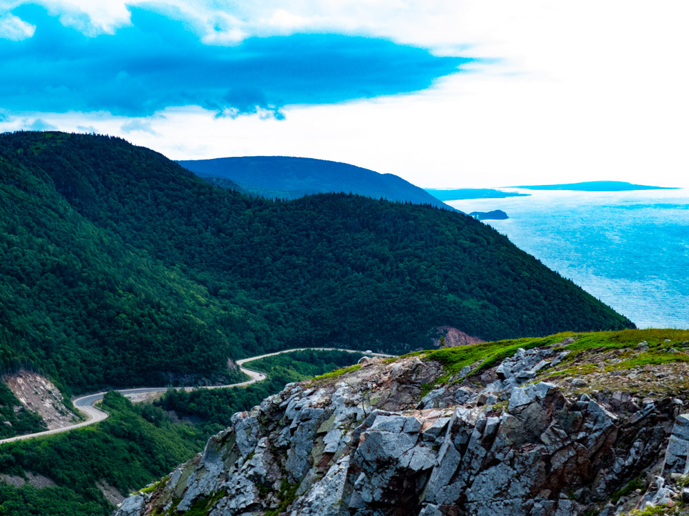
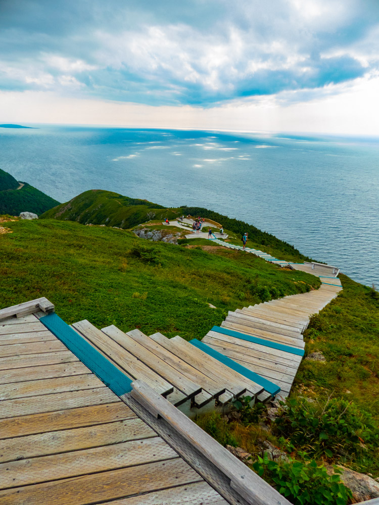
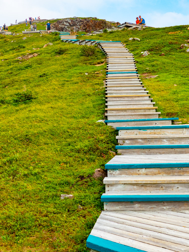
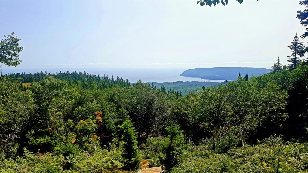
#1-Skyline Trail-Trail Rating -Easy Trail
The Skyline trail is a comfortable hike, however, I would suggest you condition yourself for the 6.5 km hike. The elevation is non-factor until you reach the final destination. The views are gorgeous. The pictures below indicate the steep declines. There are many levels down the stairs where you can take pictures. I would suggest coming early to avoid large crowds. The sun and heat are other factors to consider while hiking the Skyline Trail. There are benches along the trail to relax, take in the scenery and have a drink of water before resuming your hike. Click the on short video of what to expect during the hike.
The Skyline Trail overlooks the rugged Gulf coast. While on the trail sometimes you can encounter moose and bears and/or get a glimpse of whales in the water. The trail is mostly flat, just be careful to stay on the trail in order to not ruin, fragile vegetation. The trail can be completed anywhere from 1.5-2.5 hours with a total distance measuring 6.5 km(4mi). There is a loop you can do which spans 8.2kms taking roughly 2-3 hours to complete. Just a note, the loop was closed and under construction when I hiked the Skyline Trail.
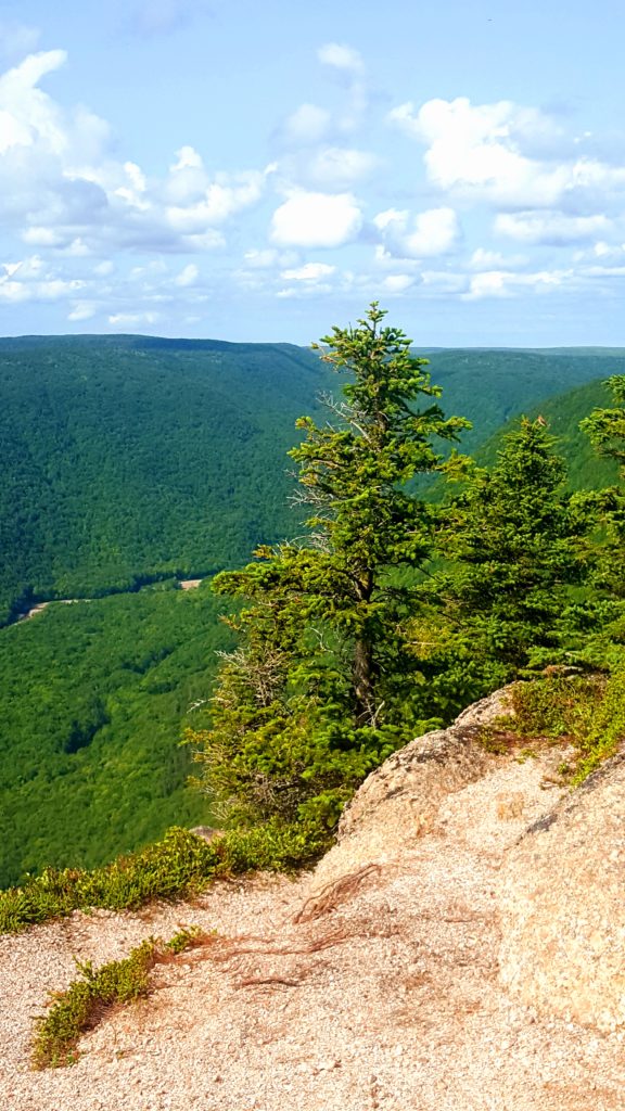
#2-Franey Trail- Trail Rating-Diamond Difficult Trail
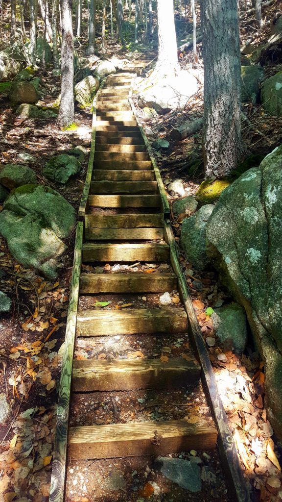
For those of you looking for a challenge and are in extremely good shape, I would try hiking the Franey Trail. It is located on the Ingonish entrance side of the island. I should stress that this hiking trail is extremely difficult and ranging in elevation from 310-1410ft. It will take anywhere from 2-3 hours to hike. There are no benches along the trail, so physical conditioning is a must for this trail. I did this climb because I wanted to know and feel the difference from an easy, moderate and difficult trail. My conclusion is that this trail is definitely a difficult trail. Make sure to bring hiking poles to help with the ascent. Franey’s steady and steep inclines open to panoramic views of Clyburn River canyon and Atlantic Ocean.
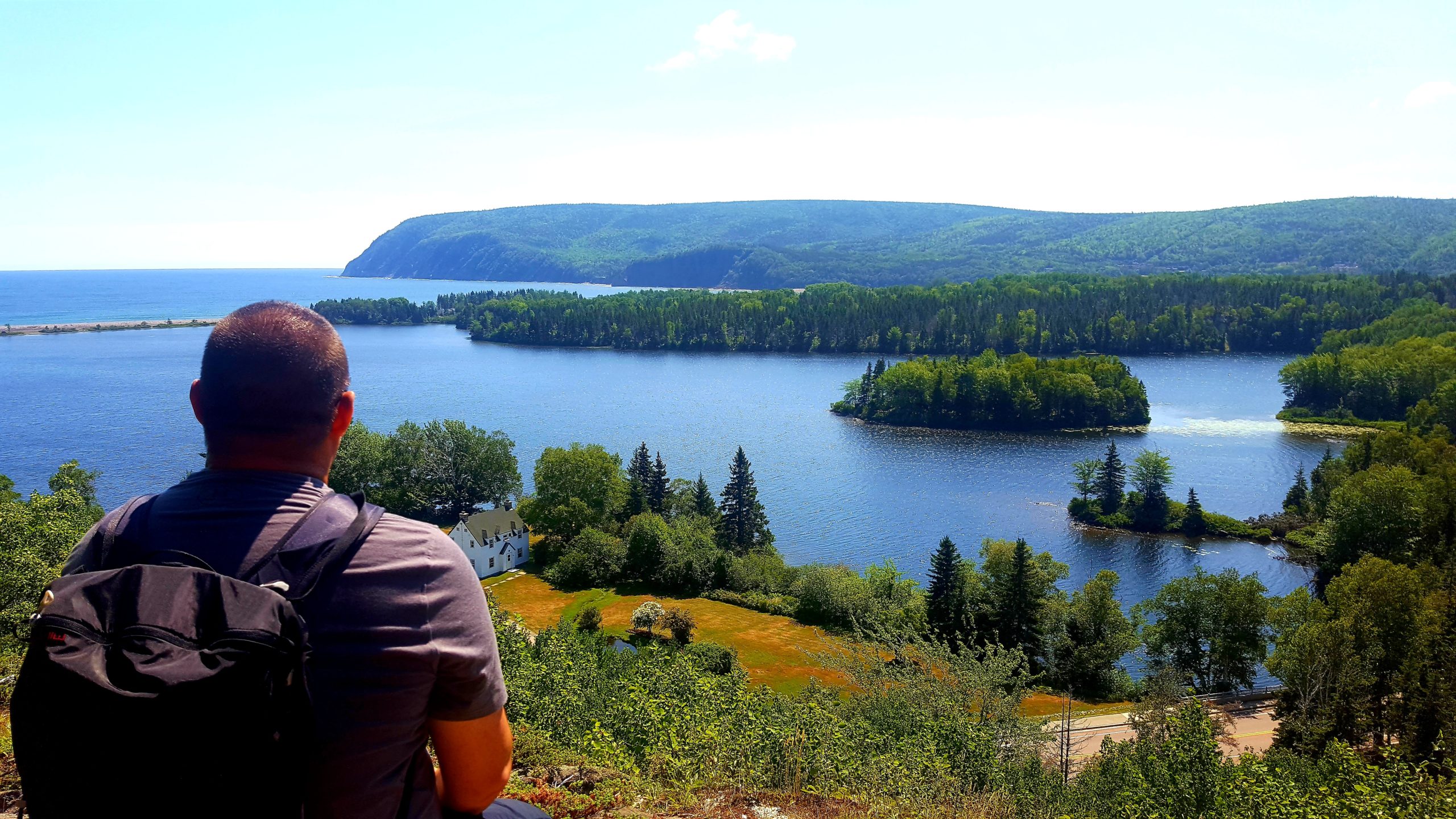
Just a suggestion, if you wanted to know if this hike is for you, I would suggest hiking Freshwater Lake Look-off, located across from the Ingonish visitors centre. This is a much shorter hike, yet it will give you an idea of what to expect. Freshwater Lake Look-off trail is my number three hiking trail.
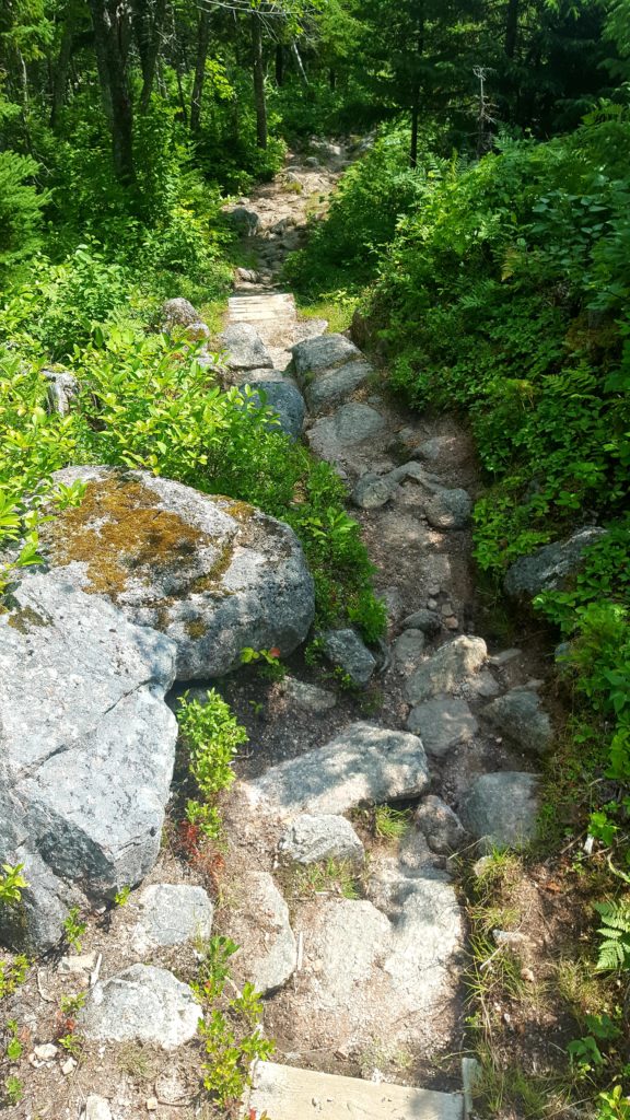
#3-Freshwater Lake Look-off is located across from the Ingonish visitors centre.
Freshwater Lake Look-off hiking trail is roughly a 10-15 min hike, ascending 0.3km. It does not seem long, however, this short hike will challenge you. I would highly recommend hiking poles for this hike. If you do not have hiking poles, there are some, left by others, right at the beginning of the trail. Below are some pictures for you to get an idea of the trail. I hiked this trail before tackling Franey Trail and I am glad I did.
The trail is an ascending climb (view picture below) of steps to climb up to the peak. I was not prepared for that, it seemed really weird because I have never did a hike like this. Once you reach the top, the panoramic oceans views were amazing. Spectacular to say the least. Clearly if you are on the Cabot Trail, with limited time, this is the hike for you. Best reward for shortest hike, hands down!
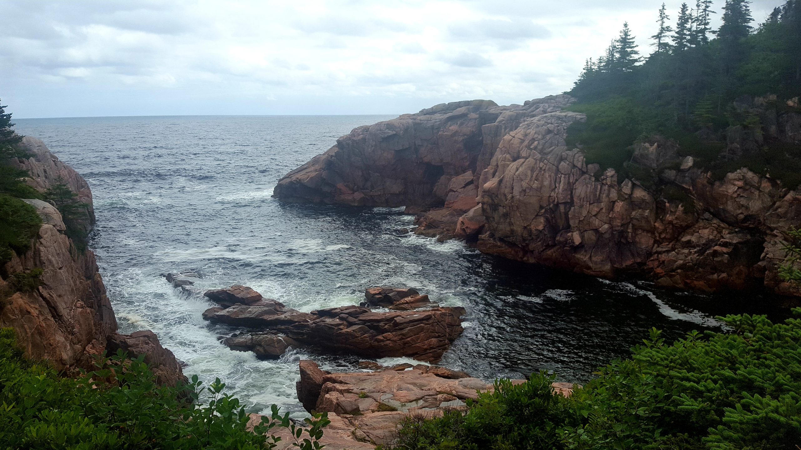
#4-Jack Pine Trail: Trail Rating Easy
Jack Pine Coastline hiking trail has a unique landscape. It has a unique forest to the area, surrounded by the ocean and beautiful rock formation. The hike was a chance for me to experience the birds and plants that call this place home. The trail distance is roughly 2.3 km (1.4mi) with elevation of 0-50m. This leisurely hike, along the Cabot Trail, uncovers the stunning beautiful rock formation and waterviews. View picture below to the scenery. Clearly a hike if you have time. The hike is rated easy. So stop by and enjoy!
#5-Freshwater Lake Trail-Location: Ingonish Beach-Easy Trail
The Freshwater Lake trail starts at the famous Ingonish Beach. There is room for parking. There is a concession stand to get, food and drinks. This trail can be done without hiking shoes, and poles. You may want to bring a backpack with towel and swimming trunks. After the trail, you can take a refreshing dip in Ingonish Beach.
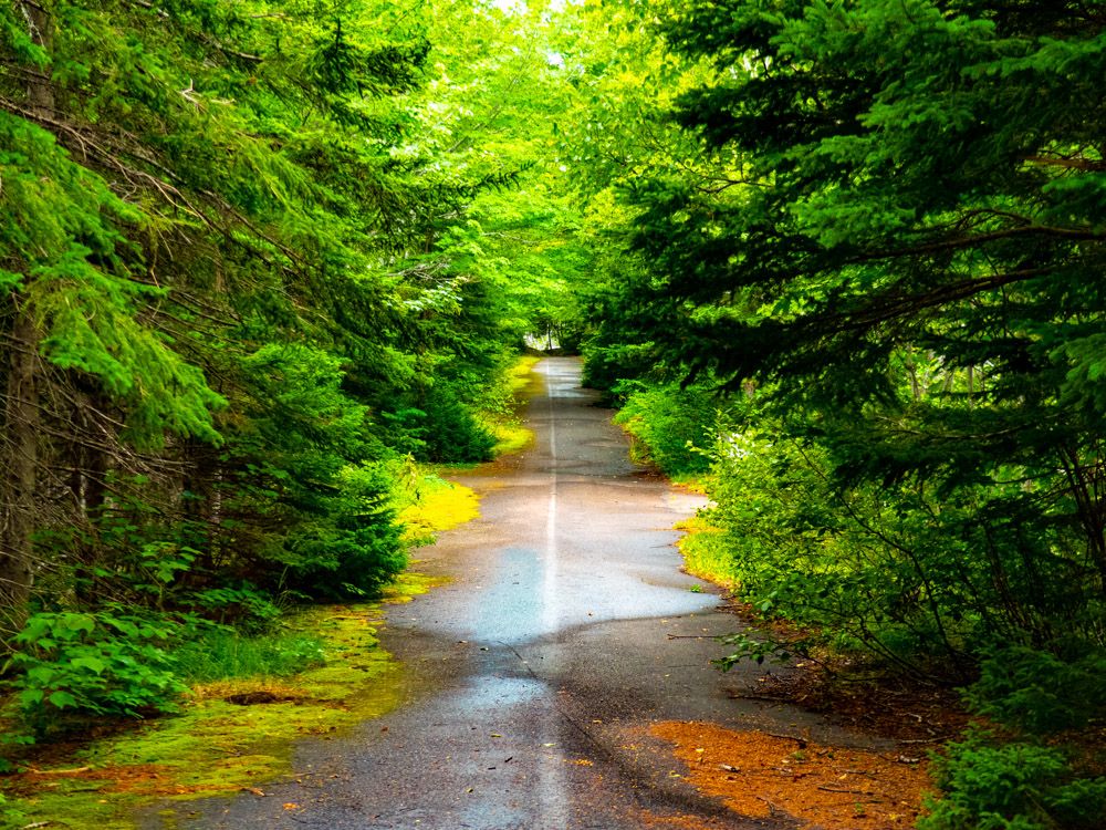
The trail is a relaxing trail, with benches to stop and view the beautiful birds. Truly a relaxing way to enjoy your time and taking the sight and sounds in. The trail will take you roughly 30-40mins. Distance is roughly 1.7km(1.1mi), with no elevation. This trail is rated easy. Click on short video below on what to expect.
This concludes my top 5 hiking trails in Cape Breton. All this hikes are off the Cabot Trail. You may want to check my youtube channel. I will be uploading videos shortly. This will give you a sense of what it is like and what to expect. I hope you enjoyed the post. Please leave a comment of what you thought or any suggestions.
As for some of the pictures, I used a beginner Lenix camera and literoom for editing for the Skyline Trail and Freshwater Lake Trail. As for the remainder of the trails, I used a Samsung galaxy 5 that eventually was replaced. I ended up dropping it into water. It was hard to retrieve these pictures, no editing in places. The pictures were taken 2 years ago, in 2018. The pictures are mine alone. I wanted this website to be about my travels and to help others that have the same zest for traveling, hiking and photography.